2 South Shore bike projects gain significant momentum
By Kathryn Reed
While implementation of new bike trails at Lake Tahoe seems to move at a glacial pace, on the same day boards on both sides of the South Shore unanimously approved aspects of different projects that will eventually link together.
First came the approval Thursday by the California Tahoe Conservancy board (with Larry Sevison absent) to spend $50,000 that will fund appraisals, preliminary title reports, easement descriptions, maps, surveys and application fees. Also approved was the mitigated negative declaration and mitigation monitoring report for the South Tahoe Greenway.

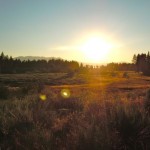
Rabe Meadow is where the first section of the Stateline-to-Stateline bike trail will be built -- starting June 2012. Photo/Kathryn Reed
The original 9-plus mile trail from Meyers to Stateline has been condensed to 3.86 miles starting in Sierra Tract and ending at Van Sickle Bi-State Park.
“The highest priority is to connect Bijou Park and the community college,” project manager Sue Rae Irelan told the board Sept. 15.
CTC is scheduled to go before the Tahoe Regional Planning Agency board in October for a project permit, which if approved, would be good for three years.
Irelan told Lake Tahoe News the earliest construction could begin is 2013. Funding will be the next biggest hurdle.
Deputy Director Ray Lacey reminded those at the meeting at Riva Grill that when the Conservancy was first founded 30 years ago one of the main goals was to acquire the old Caltrans right-of-way.
Three decades later, that is being done, with the Greenway following much of the route that at one time would have been a highway.
While part of the land is still going to be paved for the bike trail, it won’t be as wide, nor will it have the other environmental impacts a road would require. However, board member and South Lake Tahoe Councilwoman Angela Swanson said the city would like permission for its motorcycle cops to access the trail when necessary. Silence followed her comment.
That afternoon in Stateline, Douglas County commissioners unanimously approved four items related to the State-to-Stateline Bikeway.
The 30-mile route is broken up into three main sections – the South Demo project, central area, and North Demo project. It goes from Stateline to Crystal Bay.
It is the 3.2-mile South Demo project in Douglas County that will be built first. The final design is expected in February, bids sought in April, and dirt being moved in June.
This will be built in three phases, ideally in three consecutive building seasons, according to Alfred Knotts. He is project manager with Tahoe Transportation District – the lead agency.
A joint environmental assessment has been signed off by the TRPA and U.S. Forest Service.
The three South Shore segments are broken up as follows:
• Casino area to Kahle Drive
• Kahle Drive to Elks Point Road
• Elks Point Road to Round Hill Pines.
The middle section will be built first because it is all on Forest Service land through Rabe Meadow.
“It’s a heavily used trail in the existing form,” Knotts told the commissioners.
The latter section will finally provide non-motorized access to the beach at Round Hill Pines – also a Forest Service property.
Planning has begun on the north end, with a site visit last week. More difficult terrain issues exist there. A meeting about that section is scheduled for Oct. 5 at 6pm at the Chateau in Incline Village.