King Fire explodes to 70,000 acres; Hwy. 50 closed


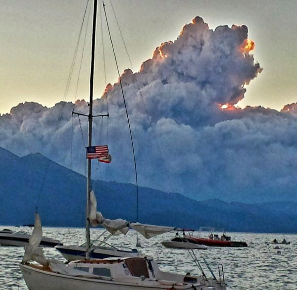
Smoke clouds from the King Fire appear to be on fire. Photo/Toogee Sielsch
The King Fire outside of Pollock Pines has swelled to 70,944 acres. It remains at 5 percent containment.
Highway 50 is closed from Pollock Pines to Riverton.
Because of the steep terrain it has been difficult for firefighters to get a handle on the blaze that is now in its sixth day of raging through the Eldorado National Forest.
The dense forest, though, is also home to a number of permanent residents and U.S. Forest Service cabins. There are 2,007 single residences and 1,505 other minor structures that are threatened. All of those people living there have been temporarily displaced. A slew of mandatory and voluntary evacuations remain in place.
The evacuation center is at the Seventh-day Adventist Church in Camino. Another Red Cross evacuation center is located at 6530 Wentworth Springs Road in Georgetown. Lake Tahoe Humane Society has provided cages for small animals because the West Slope ran out of them.
On Wednesday, Gov. Jerry Brown issued an emergency proclamation for El Dorado and Siskiyou counties because of the King and Boles fires. The Boles Fire is the one that swept through the town of Weed.
Smoke is expected to continue to be a problem for Truckee, Carson City and Reno areas. Washoe County is reporting unhealthy air quality. Thunderstorms are in the forecast for the next three days.
Nearly 3,700 people are working the King Fire with 299 engines, 15 helicopters, 49 dozers and 68 water tenders. Crews from Lake Tahoe are at the fire. The cause remains under investigation.
— Lake Tahoe News staff report

As you can see in the pic it looks like it is getting closer because it is. Fire is about 5 miles west of Loon lake. Loon lake is about 10-12 miles west of Rubicon Bay -Tahoe. Looks like the winds will change tonite to the northeast and then east which will blow the fire back onto itself.
I smelled the smoke last night about 3 in the morning over at the Y,I had my window open,Had to close it, Prayers .
I smelled the smoke last night, too. This fire is a monster. We can only hope and pray that it does not make it to the basin.
Nasty
Toogee, Great photo of the smoke plume, scary but a good shot nonetheless!
Tahoeanhiker,Yes, Loon Lake is NOT that far away from So. Shore , a little too close!
I’m familiar with that area and my hopes are that Desolation acts as a fire break.
Keepin’ my fingers crossed that this fire is out soon. OLS
Great picture Toogee. Positive Thoughts to our firefighters, the Tahoe basin and everyone between here and there.
it is expected to reach the north shore of lake tahoe late tommorow afternoon if the winds continue in a NE directon. It covered 10 miles last night. if you live in or near squaw, tahoe city, alpine maedows, get ready.
Correction, it covered 15 linear miles last night.
I see Desolation Wilderness is now closed, along with other forest closures.
http://inciweb.nwcg.gov/photos/CAENF/2014-09-14-2321-King/related_files/pict20140818-144527-0.pdf
Positive thoughts and prayers to all the people working on or affected by the fire. I hope that everyone makes it home safely to their loved ones.