Crews losing ground on King Fire
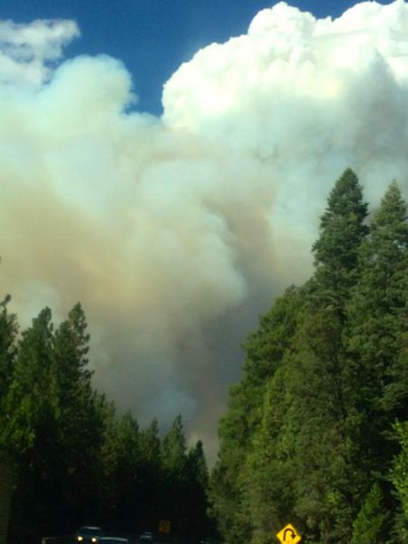
A huge plume of smoke covers Placerville. Photo/Renee Gorevin
Updated Sept. 15 11:55pm:
The King Fire near Pollock Pines grew to 8,600 acres on Monday night, with 5 percent containment.
Highway 50 is reduced to one lane through the fire area.
The California Air Resources Board will be installing a temporary PM2.5 monitor at South Tahoe High School to monitor smoke from the King Fire in Pollock Pines.
Under normal circumstances there is a PM10 monitor located in South Lake Tahoe. It only measures coarse dust particles such as rushing or grinding operations and dust stirred up by vehicles traveling on roads — not smoke particles.
The smell of smoke is evident in parts of the basin, and from many areas it can be seen.
Several firefighters on Sept. 15 had to deploy their fire shelter. CalFire said everyone in safe. Earlier a firefighter had been injured. The extent of the injuries is unknown.
The fire, which erupted in the late afternoon Sept. 13, is burning in a canyon of the South Fork of the American River, northeast of Pollock Pines. It is spreading at a rapid rate.
All Pollock Pines schools will remain closed on Sept. 16.
Highway 50 remains open. However, Forebay Road at Blair Road and Forebay Road at Pony Express Trail are closed.
Mandatory and voluntary evacuations remain in effect for hundreds of residents. Sierra Ridge Middle School is being used as a shelter for people and small pets.
The cause is under investigation.
Agencies from throughout Northern California are working the fire, including crews from Lake Tahoe.
— Lake Tahoe News staff report