Hiking adventure proves it’s a dog’s life
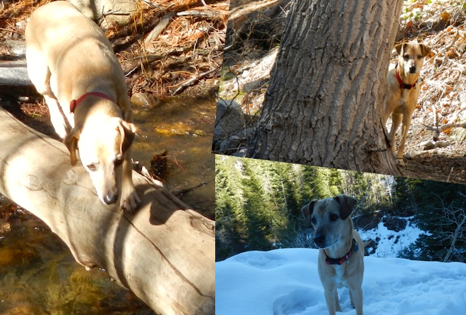
Aj spends her 12th birthday exploring the Mount Rose Wilderness. Photos/Kathryn Reed
By Kathryn Reed
RENO – AJ’s birthday hike was no piece of cake.
This 12-year-old – that’s 84 in human years – is much sprier than her much younger mommies. As if we needed a reminder. What was a 9.2-mile loop for us had to have been at least 1½ times that amount for the dog. She can be like the Energizer Bunny – she just keeps going and going and going.
This is what she lives for – being in the outdoors, romping in new terrain, sniffing all those delicious scents that never cross my olfactory senses and quenching her thirst from pristine water flowing from higher elevations.
When we first planned this for Feb. 14, snow had not fallen in a while and the U.S. Forest Service said the trail was free of any white stuff. Naturally, it snowed the week we were going. But because it is much lower in elevation we figured we would be OK in just hiking boots. And we were, despite going down on the slick snow a few times. Poles would have been a tremendous help, but they were in the garage.
The Jones-Whites-Thomas creeks trail system could keep us entertained for days.

It doesn’t take long for pretty views to unfold.
This loop has a little bit of everything. We went in a counter clockwise rotation based on the advice of visitor center staff. From the parking lot it is 0.6 miles to the start of the loop.
From there the terrain is similar to being in the Lake Tahoe Basin, but more barren. Plenty of pines loom overhead, but it’s not dense. It doesn’t take long before we are climbing. This provides spectacular views of far off mountains as well as parts of Reno. Behind us the slopes of Mount Rose are all covered in white.
A segment of this trail is open to mountain bikers. All were courteous to let us know they were approaching.
Farther along we come across some downed trees that require scrambling to get over. AJ, showing off her part Greyhound agility skills, leaps across the debris as though it’s a fun obstacle course.
Plenty of water is running in the creeks so AJ didn’t need any bottled water. She even trotted across logs to get to the other side. Her people were a little less confident in their ability to balance.
While we made it across the water without getting wet, there are four stream crossings that in a more typical winter or heavy spring runoff might prove to be a bit more challenging.
As we start a long trek west we know at some point we need to head south to get back to our starting point. But we’re in a canyon and the terrain to our left looks steep. We didn’t really descend that much, did we? Won’t there be some sort of cutoff to get us back without going up?

Mount Rose Ski Area, in the distance, is visible at different points.
Up we go. And that’s when the snow goes from spotty to consistent. Luckily, others had gone before us. While there had been good trail markers, in the snow we would have had no clue where to go without others first “paving” the way.
At times we punch through to thigh-high snow. It becomes slow going. But it is still so incredibly beautiful that our whining is short-lived.
We make it to the top – again. More views, more picture taking. It’s an easy descent, but by this time we are getting chilled and fatigued. (At one point I was in shirtsleeves.) AJ on the other hand looks like she could keep going, right until she curls up on the blanket in the back of the Jeep.
—–

Getting there: The scenic route from South Lake Tahoe – go east on Highway 50. Turn left on Highway 28 at the top of Spooner Summit. Turn right onto the Mount Rose Highway in Incline Village. There is a sign for the Jones Creek trail system on the left. This is well beyond Mount Rose Ski Resort. The visitor center is on the right; drive a little farther to the trailhead.
The less scenic route from South Lake Tahoe would be to drive to Carson City and then come up Mount Rose Highway from the other side.