Foot of snow at lake level likely Thursday


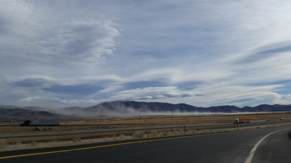
Wind churns up dust in the Washoe Valley on Dec. 9 in advance of a winter storm. Photo Copyright 2015 Carolyn E. Wright
Get the shovels ready and the snowblowers filled with gas, because 7 to 14 inches of snow is forecast at lake level on Thursday, with those numbers increasing to between 12 and 18 inches on the western side of the basin. One to 3 feet are expected at elevations above 7,000 feet.
It will start with rain and then change to snow.
And then it’s not over. Another storm is coming Sunday.
“Two strong waves like this we have not seen in quite a while. It should be a good base builder,” Zach Tolby, meteorologist with the National Weather Service in Reno told Lake Tahoe News.
The impending storm has forced the California Tahoe Conservancy to reschedule Thursday’s open house regarding the Greenway Bike Trial to Jan. 7 from 6-8pm at Lake Tahoe Community College.
Wind will be a big component of the storm as it comes in tonight. Dirt was swirling in the Washoe Valley on Wednesday afternoon. That area, including Reno, is still under a wind advisory. The strongest winds will be overnight.
The Weather Service has issued a winter storm warning for the basin for the 24-hour period starting 4am Dec. 10.
— Lake Tahoe News staff report

YIPEE!
I hope it is a huge storm,