Clear Creek: Varied landscape, fabulous views
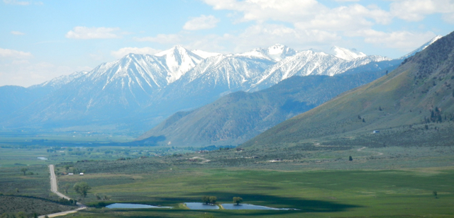
Dropping down in elevation means being able to see the mountains instead being immersed in them. Photo/Kathryn Reed
By Kathryn Reed
CARSON CITY – Rugged, desolate, colorful, stark, verdant, snow capped. Clear Creek Trail has it all.
Sagebrush is everywhere at the start, then it starts to peter out as the trail keeps going west into the mountains. The pines bring welcome shade. But they are never as thick and tall as hiking in the Tahoe basin.
A swath of mule’s ear blankets one section. But this is not a wildflower hike. A few snow plants are protruding and tiny wildflowers are out. This hike is about the views in the distance, not what’s immediately on the ground.

Butterflies are the most prominent fauna. Photo/Kathryn Reed
Still, the contrast in the landscape is welcome. As Sue put it, it was a nice change to be looking at the mountains instead of being in the mountains. The snow-capped peaks of the Carson Range were immediate, while the Pine Nuts were off in the distance.
The fertile Carson Valley seemed to never end. The lush green was clearly providing plenty of natural food for the cattle.
The trail is a mix of soft dirt and loose sand. It’s definitely single track. Most of the time there is enough room to comfortably get out of the way of mountain bikers. If sharing the trail is not your thing, this is not your hike. More mountain bikers were on this trail that is managed by the Carson Valley Trails Association than hikers.
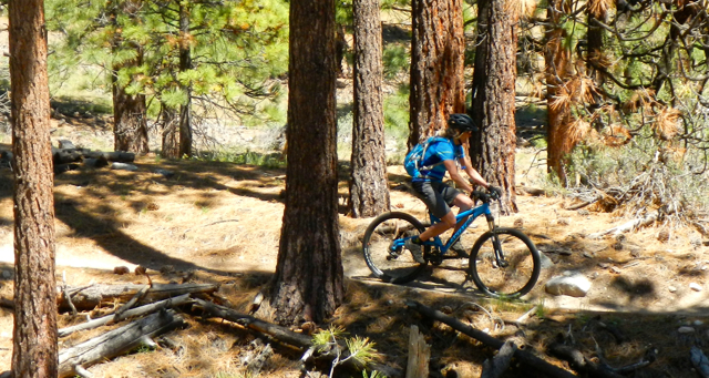
Clear Creek is a popular mountain biking trail. Photo/Kathryn Reed
At times the trail crosses private property. Signs say as much, and they ask people to stay on the trail. It proves public-private partnerships can work.
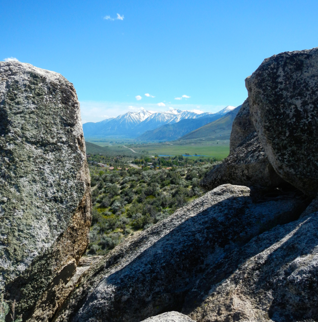
Our destination was The Knob. Having never been on the trail we didn’t know what outcropping we were headed to. I’m not sure it was ever distinct from the trail. It’s actually good there was a sign pointing us toward it.
From The Knob mostly the Carson Valley spills forth. Immediately to the left it’s possible to see vehicles coming down Spooner Summit, but it’s impossible to hear them. Greens belonging to the private Tahoe Golf Course seem within reach.
There is something to look at around every switchback. Photo/Kathryn Reed
The 14-mile round trip hike in some ways feels less than that because the grade is gradual (5 percent or less most places) and the elevation gain (start 4,950 feet, highest is 6,200 feet) is not that much. Plus, the highest point is the same as Lake Tahoe’s elevation.
About 3,100 acres here are managed as winter deer range. After a fire in 1966, 700 acres were replanted for forage and ground cover. While this is mule deer country, we didn’t see any. In fact, other than hearing a few birds the fauna did not make themselves known.
Dogs are allowed off leash if they are under control. This is rattlesnake country, so that is something to consider. Clear Creek provides water, at least in May. This is one of those hikes, though, where I was glad I brought water for AJ. Even in May she needed more than just the stream crossing.
A gentle breeze cooled us off. This would definitely be a super hot trek in mid-summer.

Much of the trail is exposed. Photo/Kathryn Reed
—–
Getting there:
It will depend where you are coming from because the trail can be accessed from Kingsbury Grade or Spooner Summit.
The trail begins on the southwest side of Jacks Valley Elementary School.
Coming from Kingsbury Grade it is on the left side. It is well marked.