Carson River, grasslands, sage dominate easy hike
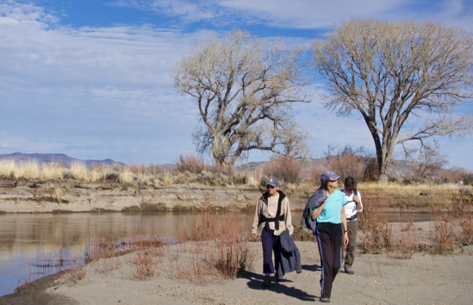
Rhoda, Liz and Rosemary along the Carson River on the Bentley Heritage Trail. Photo/Kathryn Reed
By Kathryn Reed
MINDEN – Meandering through grasses more than 6-feet high, mesmerized by sage bushes just as tall and with thick trunks, a brief oops where the trek went through slick mud, the Carson River wending its way through the valley as the snow covered Sierra peaks scratched the sky – all of this provided more reasons to be thankful on Thanksgiving weekend.
With the recent snow in Tahoe, hiking at any elevation above lake level may necessitate snowshoes, and yet it doesn’t quite feel like snowshoe season has truly arrived. To keep hiking this time of year requires dropping in elevation. That’s just what the four of us did the day after Thanksgiving.
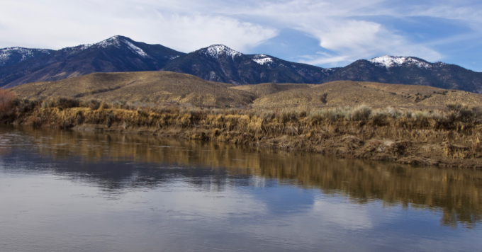
The Carson River and Sierra mountains are focal points along the trail. Photo/Kathryn Reed
The Carson Valley Trails Association has been busy creating a trails throughout the Minden-Gardnerville-Genoa area.
This particular one – the Bentley Heritage Trail – is like being in the middle of nowhere, and yet so close to civilization.
We are so used to hiking in the Tahoe area that is was strange to have no elevation gain. A 1 percent grade is what you’ll encounter.
With no trees, it seemed like you could see forever – which was wonderful.
While the network of trails here is 4.8 miles, what is great is that hikers can easily make it shorter. This is because trail builders made several links from one side to the other. The other nice touch was the off-shoots to the Carson River.
Our goal was to make a circle. We kinda did that.
Private property via an easement has created this nearly 5-mile trail system. Photo/Kathryn Reed
While at first I was thinking the signage was wonderful, there were a couple incidents where we weren’t quite sure where to go. The main obstacle was when we got to what I would call the end of trail before it curves around to head back. The arrows pointed left and right. We thought we needed to go right to keep with our plan to go counter-clockwise. Well, it turns out this was one of the spurs to the river and not the actual trail. After a muddy adventure near the water, we turned around and figured out our mistake.
We also weren’t sure which direction to go at another junction. Instead of completing the circle, we wound up going across to the side we started on.
Neither of these hiccups was that big of a deal, but for first-timers a little more info besides an arrow would have been nice. Things like “river,” “trailhead,” “eastern trail” would have kept us where we wanted to be.
Still, we’d all recommend this trail – just not in the summer or anytime it is hot. It is completely exposed, with zero shade. The river might provide some cooling off, though.
It was easy to see how high the river had been this spring based on the erosion along the banks and the wash along the side.
A surprising find were some tiny clam shells along the shore, that to this non-scientist looked like the invasive clams found at Lake Tahoe.
Carson Valley Trails Association, with the Nature Conservancy, local Eagle Scouts, and the property owner built the hiking trail system.
The trails association had to replace some of the boardwalks this year that had been ruined by the spring flooding.
The biggest negative for me is that dogs are not allowed. This is because cattle could be in the area. Horses, bikes and motorized vehicles are also not permitted. But I’m thankful the private property owner agreed to the easement that allows the public onto these lands. The easement protects four miles of the Carson River, conserves wildlife habitat, safeguards more than 1,000 acres of floodplain, and encourages sustainable agricultural practices.

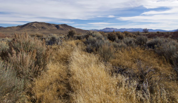
This hike is mostly a single-track trail through grassland. Photo/Kathryn Reed
—–
Getting there:
From South Lake Tahoe head east on Highway 50. Go right onto Kingsbury Grade. At the bottom, go left on Foothill Road. Turn right on Muller Lane. Turn left onto Highway 395. Turn right on Stephanie Lane, then left on Heybourne Road. The trailhead is to the left and is well marked.