Quake expert shakes things up with talk of Tahoe faults
By Kathryn Reed
STATELINE — “My fear is we don’t even remotely have a clue how to deal with something like this.”
Those are the words of Graham Kent, director of the Nevada Seismological Laboratory and professor of the Department of Geological Sciences and Engineering at UNR. He is speaking about when the next big quake hits Lake Tahoe and a tsunami wipes-out much of what’s on shore.
The West Tahoe Fault hasn’t had major action in 4,500 years. Scientists say it’s due because history shows it erupts every 4,000 to 5,000 years.
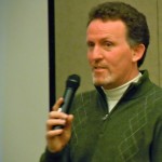
“This is a big, big fault,” Kent said as he spoke to Soroptimist International South Lake Tahoe on April 20 at Harrah’s Lake Tahoe.
Besides being a leader in his field, Kent is a 1980 South Tahoe High School graduate. So, this isn’t just work for him – it’s a bit about educating his hometown about the dangers that lie beneath Angora, Cascade, and Fallen Leaf lakes, as well as the Incline Village and Stateline faults. Then there’s the Genoa fault in the Carson Valley.
What Kent sees as a danger is the lack of monitoring that is going on in Tahoe. No equipment exists on the East Shore. He is hoping to change that.
He believes officials are not planning for what an earthquake and subsequent tsunami would do to the region.
Kent showed computer-generated videos of what the water surge would look like – making some comparisons to the March tsunami in Japan.
“We need to do a much better job of putting signage on beaches. There are 17,000 people (on Tahoe) beaches in the summer. They wouldn’t get out,” Kent said.
He doesn’t want to be an alarmist, but he does want to be a realist. He sees what other countries are doing when it comes to earthquake research compared to the United States and he’s dismayed. He sees what the Northwest does to warn people about tsunamis and evacuation routes and can’t believe the dialog isn’t even happening in the Lake Tahoe Basin.
Kent is hoping his agency will be able to change that – in terms of education and obtaining better data about what is going on when is comes to seismic activity in the Lake Tahoe Basin.
This audience was the first to see lidar (light detection and ranging) images of the Tahoe faults. This technology helps to better define the faults for the naked eye.
These images are available online, then search for Tahoe.
He said as much as the basin keeps putting money toward fine sediment reduction, it would take one earthquake a matter of seconds or minutes to undo all that work.
“Tahoe is strewn full of catastrophic events,” Kent said.
Kent’s crews will be doing work on the Stateline fault this summer. He hopes to get onto Cascade Lake next month to do research. And when the snow melts, he will be walking the West Tahoe Fault at Angora to find out more about the area where he spent many a summer jumping off the cliffs into the lake.


Nice article, Kaye. Thank you.
How would signs on the beach do anything to help people “get out”. This would be an absolute waste of money. If there is a seismic event that creates a tsunami, the entire South Shore would be flooded in seconds. All roads in and out of the basin would be unusable. Signs won’t help. Good article, makes one think…
DUMBfounded. You are wrong.
One more reason to take hold of the TRPA reins – He said as much as the basin keeps putting money toward fine sediment reduction, it would take one earthquake a matter of seconds or minutes to undo all that work.
Ok Bob. We should not do anything, because in the future there is a slight chance of an event that may undo most of the work…