Sierra water content 20% of average
Results of the Jan. 3 manual readings by the Department of Water Resources:
| Location |
Elevation |
Snow Depth |
Water Content |
% of Long Term Average |
| Alpha |
7,600 feet |
7.9 inches |
2 inches |
15 |
| Phillips Station |
6,800 feet |
9.3 inches |
2.3 inches |
20 |
| Lyons Creek |
6,700 feet |
15.4 inches |
3.6 inches |
31 |
|
|
|
By Kathryn Reed
PHILLIPS STATION – While there was snow to be found during the first water content survey of the season Friday, it was minimal.
The readings taken Jan. 3 in the field next to the entrance to Sierra-at-Tahoe along Highway 50 measured 2.3 inches of water content, a snow depth of 9.3 inches for what amounts to 20 percent of average. This makes it the second driest reading on record for this time of year.
Two years ago Gehrke was walking on dirt, while in 2013 there was about six times the amount of snow there is today. But both years turned out to be dry water years, and this is looking like it will be the same.
Phillps Station had its lowest water content reading of 0.1 inch in 2012, in a snow depth of 0.6 inches. On Jan. 2, 2013, at the same location 12.1 inches of water in 48.8 inches of snow were recorded.
Of the 50 years that records have been kept, other dry years include 1987 (0.9 inches of snowpack water content), 1981 (2 inches), 1976 (2.7 inches) and 2000 (3 inches).

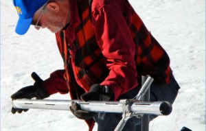
Frank Gehrke with the Department of Water Resources on Jan. 3 measures the water content of snow at Phillips Station. Photo/Kathryn Reed
While Gehrke was taking his readings, Gov. Jerry Brown’s Drought Task Force that he created last month was meeting.
“It’s not good news (for reservoirs),” Frank Gehrke with the Department of Water Resources said. “We are really eating into the reservoir storage.”
Sierra snowpack feeds the reservoirs downstream, which in turn provide for about one-third of the drinking and irrigation water for California.
Lake Oroville is at 36 percent of its 3.5 million acre-feet capacity and Shasta Lake is at 37 percent of its 4.5 million acre-feet capacity.
December, January and February are usually the wettest months of the year. December was disappointing and January is balmy. It’s possible today’s record high of 58 for South Lake Tahoe that was set in 2012 could be broken. South Lake broke a record Dec. 31 with a high of 57. The previous record of 54 was set in 2011.
While there is a slight chance of moisture for the Lake Tahoe Basin on Jan. 7, the temps will be warm so it could just be rain.
Meteorologist Zach Tolby with the National Weather Service in Reno told Lake Tahoe News, “We are not expecting a lot of precipitation out of it. Then it gets unpredictable after that.”
Besides needing to ration the water coming out of the tap, dry winters affect recreation, the environment and the economy.
Plus, with the ground being dry much of the snowmelt is going into the ground instead of going downstream.


