Fallen Leaf Lake trail network to be revamped


Improvements are coming to Fallen Leaf Lake dam and surrounding trails. Photo/LTN file
Upgrading the trails around Fallen Leaf Lake and creating new ones could take five years, with the first phase beginning next week.
This summer a new bike path from Fallen Leaf Campground to the Pope Baldwin Bike Path will be built. (The latter trail is better known as the Camp Rich paved path.) Several trails on the north end of Fallen Leaf Lake will receive upgrades, and others will be rerouted and reconstructed. A number of user-created trails will be decommissioned.
The trail along the west side of Taylor Creek that runs north and south will remain, but be improved. This includes slope stabilization. The Clark and Church trails will also stay.
The polo field parking lot near the entrance to Valhalla has been incorporated into the Tallac Site plans. Improvements to the Camp Richardson paved trail will be part of the Camp Rich plans. While the projects are separate, the Forest Service has an eye on the big picture so everything is designed to flow together and complement the other.
Expect temporary closures or restrictions in the areas being worked on. The U.S. Forest Service, which owns the land, is warning that noise and visual impacts may affect the Fallen Leaf campground and surrounding areas.
Two of the goals of the project are to reduce congestion and user conflicts. These trails are heavily accessed by locals and visitors. The hope is that with more trails it will better disperse users.
The entire project area encompasses 14,960 acres on the South Shore.
Future work will include reconstruction and rerouting portions of the Mount Tallac Trail, new trailheads and parking areas developed in several locations along the Highway 89 between Camp Richardson and Spring Creek Road, and the last one-quarter mile of the Camp Rich trail will to be moved to a more appropriate crossing and access point on Highway 89.
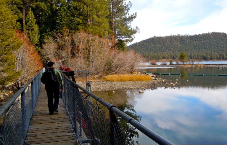
The 80-year-old dam at Fallen Leaf Lake-Taylor Creek will also be revamped to allow for cyclists to ride over it without having to lift a bike up steps.
Plans call for a new trail connecting the Pope Baldwin Bike Path from the Spring Creek Road area to Fallen Leaf Lake, a trail connecting the Fallen Leaf Campground area to Angora Ridge, and a trail connecting Angora Ridge to the North Upper Truckee neighborhoods. All of that is dependent on money.
The work scheduled for this season comes from the Forest Service Legacy Trails Capital Maintenance and Improvement Fund.
More info about the project is online.
— Lake Tahoe News staff report

I hope, for the safety of all, that the Forest Service will post reminders of the rules of the road for the multi-user trails. Vehicles (wheeled traffic)ride to the right; foot traffic (runners and walkers, if that requires defining) stay to the left facing on-coming traffic.
Bicyclists are usually pretty good about letting foot traffic in front of them know where they’re going (“to your right” if everyone’s where they’re supposed to be) but a lot of tourist foot traffic is unfamiliar with the procedure and often jumps the wrong direction when a voice behind them interrupts their reverie. I don’t know what the record of accidents is, but I’ve been a bicyclist, runner and walker at various times on the existing trails and have seen and experienced countless near misses.
On EVERY multi-user path/trail (not roads for cars) I have ever been on (and I am on at least one every week, traffic (bikes, horses and people) stay to the right. When you pass, people should hear “on your left”. The rules you give are correct for paved roads.
I ride a mountain bike and I hike but I mainly hike. The Valley View Trail off the corner of LT Blvd and Tahoe Mountain has been turned into an entire network of mountain bike trails. In addition to the numerous old roads and trails, the FS has built in some new loops. Now, going up the Angora Road on both ridge lines the will be more mountain bike trails so that cyclists will be able to access Angora Lookout and resort by the road or on either ridge line. Most trail networks provide for a few trails that are closed to bikers for reasons of safety and user enjoyment. It is getting so that in order to hike without bikers zooming past you need to go on the PCT or into Desolation. Yes, bikers and hikers can use the same trails and usually bikers are quite courteous but not always. Often bikers do not let you know they are approaching from behind, they just get near enough so that your reflexively jump out of their way. While hikers have the right of way, I know of no hikers who do not yield the trail to bikers as a matter of common sense. When you are constantly stepping aside to let bikers pass and watching for them to come rapidly downhill from behind, it diminishes your relaxation and sense of the outdoors. A friend was almost hit on the Hawley Grade the other day. I think the pendulum has swung too far in the direction of mountain biker access and some trails need to be set aside for the quieter enjoyment of hikers. One of the routes up to Angora would be a good place to start.
There are already two trails from Fallen Leaf to Angora–the Clark Trail and the Chapel trail.
Thanks Lisa; you’re almost certainly correct for single track unpaved paths. But I meant to limit my comment to the paved bike trails where all sorts of users cluster, mostly ignorant of how courteous usage is supposed to work, regardless of the somewhat confusing laws.
I often find myself in Anaheim, using some paths, paved or unpaved, in the nearby hills. But I have no expectation that Southern Californians will understand how trails and paths are supposed to work. At home, near Lake Tahoe, it seems to me that we should all be working together. And hoping the visitors will participate as well.